National parks of Russia are special territories where conditions have been created for the preservation of unique natural and historical complexes. But unlike nature reserves, here you can take an excursion along an ecological path or spend a vacation in a recreational area. In order not to harm the environment, before visiting the selected site, it is recommended to study the likely division of the territory into parts with a different status.
Tourists are allowed to stay in special recreational areas or travel with an instructor. If hunting or fishing is planned, a permit is required in advance. In some complexes, these activities can only be carried out in the presence of a huntsman. And the most important thing: before visiting on your own, be sure to register with the administration and get a free map-scheme. This will ensure the safety of the traveler.
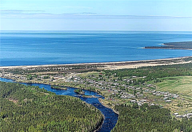
Alanya

In this most beautiful place of the Caucasus, it was planned to create a reserve back in the 50s of the twentieth century. The result of the discussion at the government meeting was the organization of 4 hunting farms: Saursky, Turmon, Makhsky, Zmeisko-Nikolaevsky, Zamankulsky. And in the late 60s, the State North Ossetian Reserve was formed. But in order to carry out complex work: scientific, environmental, educational work, it was necessary to create a special place. It was Alania, a high-mountain reserve. The decree on its formation was signed on February 18, 1998.
The place of the reserve is unique: it is located on the mountains and is surrounded by mountains. Therefore, the climate here is not only moderately continental: it is “diluted” by altitudinal zonation. The height differences are significant: from 1100 m above sea level to 4646 (this is the height of Mount Wilpat). It is interesting that the 3 groups of Alanya mountain ranges have a direction from north-west to south-east and are practically parallel to each other.
The flora of Alanya is striking in its unusualness. In small areas, they replace each other:
- beech forests
- birch forests
- maple forests
- juniper groves
- beech groves
- hornbeams
- alpine and subalpine meadows
The fauna also pleases with a variety: bears, roe deer, wild boars, chamois, East Caucasian tours live here.
A multifaceted work is underway in Alanya, therefore the reserve is divided into separate sections:
- protected
- security
- special regime
- for economic purposes
- specially protected
Due to the fact that Alania borders on Georgia, free visit to the reserve is impossible. But the administration organizes collective excursions by appointment. In addition, volunteers are invited to help the staff. Such activities will help to better get acquainted with the unique corner of the Caucasus.
Alkhanay

Alkhanai was formed recently: on May 15, 1999, but has the status of a specially protected natural area. The organizers pursued several goals:
- Preservation of unique territories. There are natural complexes in Buryatia that are not found anywhere else, not only in Russia, but throughout the world. The unusual alternation of valleys and mountains creates a favorable climate for the growth and development of rare animals and plants. There are many mineral springs with healing waters on the territory. Popular with visitors: 9 troughs and Arshan.
- Preservation of natural and cultural monuments. The territories taken under protection have long been inhabited by tribes who have left a cultural heritage. The rocks of the Alkhanai gate and the loach Alkhanay are not only unusual objects of nature, but also places where ancient tribes made sacrifices to their gods.
- Creation of conditions favorable for the existence of rare plants and animals. Alkhanai you can find unique healing herbs and relict trees.
- Organization of tourism for the purpose of recreation and training in respect for the nature of the unique reserve. The climate of Alkhanai is curative: it is no coincidence that the inhabitants of Buryatia spend their summer vacations here. The administration of the complex offers visitors both one-day and multi-day tourist routes, as well as stationary accommodation in comfortable houses. But you should book your seats in advance.
The park administration constantly organizes actions in support of the protected area. They are announced in advance in the media and on the official website of the reserve. Anyone can take part in the most interesting thematic events.
Beringia

The very idea of creating Beringia arose in the 60s of the twentieth century. At the government level, it was decided to take measures to preserve the unique section of the biosphere. The reserve is located between the Chukchi and Bering Seas, it includes both land and sea areas.
Birds and mammals make seasonal migrations across the Bering Strait. The study of their ways helps to study the development of life and the sequence of dispersal of animals on the planet. In this region, wildlife still feels like a full-fledged mistress, so any naturalist dreams of coming here to observe the processes taking place in it.
Beringia is conditionally divided into regions, each of which has significant differences from the others:
- The only sector located entirely beyond the Arctic Circle is Enurmino. Here, day and night last for six months. The climate is very cold: summer lasts only 2-3 weeks. Here you can not only observe polar inhabitants, but also study the life of a modern Chukchi village.
- The Arctic Circle passes through the Inchoun sector. This is the northern territory of Beringia. Here you can see a rock with a cut off piece. This feature gave the name to the site (Inchone - cut off the tip of the nose).
- The most eastern point of Eurasia, Cape Dezhnev, is located on the Uelen site. Every Russian dreams of visiting this place.
- The Lawrence Sector was named after the village of the same name. Now it is a comfortable modern village. Tourists are attracted by the Yandogai Cultural Center, where the traditions of local peoples are recreated.
- The Lorino site will delight guests with excellent fishing. In the village, each house has its own boat, which is ready to go out to sea.
- The Yanrakynnot sector amazes guests with the famous Whale Alley and a huge number of pits for storing meat and fish.
- The Novoye Chaplino site pleases not only with picturesque landscapes, but also with an abundance of ancient excavations (Kivak, Avan).
- Lilacs include the coastal strip. A comfortable cottage village is located here.
- An old Eskimo village is located on the territory of the Acchen site. The fattest vendace on the coast is caught in the coastal waters.
- The area of the Provideniya Settlement amazes with the abundance of hills. There is a museum of the Bering heritage in the village.
In all areas, not only excellent fishing, but also hunting. But for this, you should take care of the permission in advance.
Bikin

The reserve was created in 2015 from two territories: places of traditional nature management (Bikinskaya) and a previously existing reserve (Verkhnekhibinsky). The main goal was to preserve and increase the population of the Amur tiger. 10% of the total number of mammals lives in Russia.
But along the way, other tasks were set for the employees:
- preservation of rare species of plants and animals
- preservation of the traditions of the indigenous population (Udege, Nanai)
- regular monitoring of the environment
- organization of tourism and recreation of the population
The western slope of Sikhote-Alin has unique fauna and flora. Here live a black stork, scaly merganser, fish owl. It is noteworthy that plants of the south (rhododendron, Rhodiola rosea) and the north (cedar, ash) coexist on the same territory. The reserve acquaints visitors with the life of the indigenous population. Here are the ancient sites of the Udege, altars.You can learn more about the traditions of the small people in the museum of the village of Krasny Yar. Before visiting the natural complex, you must obtain permission from the administration.
Zabaikalsky

The reserve includes a part of the water area of Lake Baikal (Chivyrkuisky and Barguzinsky bays), forests, non-forest lands, swamps. There are villages on the territory: Katun and Kurbulik. These beautiful places have been designated as a special area in order to:
- preserve and increase populations of rare plants and animals
- conduct educational activities
- conduct research
- organize recreation and tourism of the population
The relief of the territory is mountainous. The largest massifs are the Barguzinsky and Svyatonosky ridges, the Ushkany islands, the Chivyrkuisky isthmus. The slopes are covered with taiga plants. Mammals are found in the reserve: bear, elk, lynx, fox, wolverine, white hare, squirrel. There are many birds here: hazel grouse, mallard, marsh harrier. There is an abundance of fish in lakes and rivers. Hunting and fishing are excellent here during the season. But, of course, permission must be obtained in advance. On the territory of the natural complex there are thermal mineral springs: Nechaevsky, Zmeevy. Tourists willingly rest near them.
When visiting the reserve, certain rules should be observed:
- ordinary visitors and tourists are prohibited from staying in specially protected and reserved areas
- being in the recreational area, as well as in areas of extensive nature management and economic purposes, you should not make noise and wear bright clothes so as not to frighten off rare animals
Leopard land

Over the past 100 years, the range of the Far Eastern leopard has decreased 40 times. The animal completely disappeared from the territory of the DPRK, from the southern spurs of the Sikhote-Alin. And in China he was met only near the border with Russia. Today, the main leopard population is based in the southwest of Primorye. The purpose of organizing the reserve was the possibility of a rational existence of rare animals and people living next to them and conducting economic activities.
In 2012, next to the Kedrovaya Roscha nature reserve, the Land of the Leopard was formed. Mostly, the rare animal lives on hills and rocks, in the zone of mixed and deciduous forests. The leopard is found both on the coast of the Sea of Japan and at an altitude of 800 m above sea level. And here a protected area has been created for him. In addition to the Far Eastern leopard, there are animals and plants listed in the Red Book and the Red Book of Russia.
There are fish in rivers and streams. The forests are inhabited by a wild Far Eastern cat, the Amur tiger. In order to study the habits of the Far Eastern leopard, it is absolutely not necessary to come to Primorye: a documentary film about this rare animal is being filmed on the territory of the park. The series are posted on the official website of the reserve.
Call of the tiger

The main goal of the formation of the reserve was to preserve and increase the population of the Ussuri tiger. But there were also other tasks:
- study and implementation of new methods of environmental protection
- environmental education of the population
- creation of a recreational area
The complex has the status of a specially protected natural zone (received in 2007). On the territory that has the shape of a square, not only the Ussuri tiger, but also red deer, marals, and raccoon dogs feel at ease. There are rare and endangered plants, many endemics. In these places, people have minimal impact on the environment.
Basically, these are logging in the Chuguevsky region and geological exploration of a gold deposit in the 70s of the last century. But the damage turned out to be insignificant, over time, the traces of the person were completely erased. The complex is divided into a protected area (only employees and scientists can be in it) and a recreational area (everything is provided here for the recovery and recreation of tourists). There are no stationary settlements in this most beautiful place of the Ussuri taiga.
The climate is healthy: continental with the influence of monsoons. Therefore, the administration of the center built special houses for visitors to rest in the recreation area. Unfortunately, the average visitor is unlikely to meet rare animals on the ecological trail: they are too careful. But there is an opportunity to breathe the healing air and enjoy the beauty of the region's nature.
Kenozersky

The reserve includes the territories of the neighboring districts of the Arkhangelsk region: Plesetsk and Kargopol. It has the shape of a rectangle. The purpose of the reserve is to preserve the unique landscapes and historical monuments of antiquity. The complex was created in 1991, and in 2001 was included by UNESCO in the list of biosphere reserves. Now the territory is under double protection: Russia and the world organization.
The landscapes of the reserve are extremely interesting. Marshes occupy 5% of the area. Scientists believe that all types of these formations are represented here. Unfortunately, only 3% of forests are not changed by human economic activity. And they are all located near the swamps. Tourists like Kenozero and Lekshmozero very much. They are picturesque, very clean and rich in fish. On their shores, the sites of an ancient man were discovered.
Many people tend to visit the Maselga ridge. This beautiful rock formation is part of the watershed of the Arctic and Atlantic oceans. In addition to regular tourist routes and trails, the administration of the complex holds thematic festivals. Anyone can take part in them.
Kodar

The reserve was organized in February 2018. The goal is to preserve the unique natural complexes of the Kodar ridge and part of the Stanovoye Upland. Additionally, the following issues were resolved:
- scientific work
- maintaining the living conditions of the indigenous people of the region - the Evenks
- tourism organization
- creation of recreational areas
- environmental education of the population
The flora and fauna of Kodar are unusual and varied. The terrain is mountainous, alternating with plains. The Kodar administration has prepared a wide variety of excursions for the guests:
- on boats on the rivers and Lake Nichatka
- on horseback in the mountains and valleys
- on foot (with an instructor)
- by jeeps
- combined
Climbers fell in love with Kodar: there are climbing sites of various complexity. The visit to the complex is free. If you visit Kodar on your own, you must first register with the administration.
Ladoga skerries

The reserve was organized in December 2017. The goal is to preserve a unique complex of skerries located in three districts: Lahdenpohskiy, Sortavala and Pitkyaranta. This beautiful area almost died because of the predatory interests of business executives and some officials of Karelia. Until 1945, the territory of the skerries belonged to Finland; there was a recreational area with white sand beaches. And after the region became part of the USSR, the border passed near the skerries. Of course, there was a tourist flow, but it was irregular and not intensive.
Even then, there were attempts to create a specially protected area, but the project was not approved. And at the end of the 90s of the last century, licenses were issued for deforestation and the production of rubble for the city of St. Petersburg. Fortunately, the licenses were revoked and the lease was terminated. Now tourists can admire the unique natural complex, unusual flora and fauna of the Ladoga skerries.
Lena Pillars

The decision to create a nature reserve on the territory of Yakutia was made recently: in 2017. But even up to this moment, the unique outliers attracted tourists. The guests are especially attracted by the fact that this marvelous corner of nature has practically not been changed by man as a result of economic activity. Ancient cliffs of reddish sandstone stretch along the Lena River. According to geologists, they are over 500,000 years old! The ridge formation process is interesting in itself.
Previously, this place was a warm ancient sea. It was shallow, and lime deposits accumulated at the bottom.Over time, the sea left, the Siberian plate began to move, fractures and contractions occurred. This is how an unusual shape, reddish rocks appeared. They stand most densely at a distance of 40 km from each other. And the total length is over 80 km. In the thickness of the rocks, caves with wall drawings of the ancient inhabitants of the region were discovered; in some of the hollows, altars have been preserved. But this is not the only thing that makes the reserve interesting.
The administration made sure that the guests admire the unique flora and fauna: an ecological trail has been organized. Rare specimens of the region's flora are found on it. Scientific work is underway in the reserve: the fossilized remains of the ancient inhabitants of the Earth were found in the rocks. They are readily available and in excellent condition. Lena Pillars are valuable not only for the inhabitants of Russia: UNESCO has included the reserve in the list of specially protected objects. Visiting the reserve is free at any time of the year, but while on the trail, you must follow the rules. You can get acquainted with them at the administration.
Curonian Spit

This reserve was founded in 1987. A narrow strip of sand dunes stretches along the Baltic coast. Part of the buffer zone belongs to Russia, the other to Lithuania. On the one hand, it is washed by the waves of the Curonian Lagoon, on the other, by the Baltic Sea. The reserve has the status of a strict nature reserve. This is a specially protected area.
Unusual in terms of natural parameters, the place is included in the UNESCO World Heritage List. But this place is famous not only for the dunes and the Dancing Forest. There is a unique maritime climate, the cleanest sea, and the air is filled with the smell of pine needles. An excellent recreational area has been created here. There are guest houses and hotels in the villages. They are ready to receive visitors all year round.
The place is also famous for its cultural heritage. Here you can visit:
- ethnographical museum
- fisherman's house
- Witch hill
- amber exhibition
Many beaches of the Curonian Spit have the Blue Flag. And fans of outdoor activities will be delighted by fishing, surfing and kiting.
Mariy Chodra

The reserve was created in 1985 on the territory of 3 districts (Volzhsky, Zvenigovsky and Morkinsky) of the Republic of Mari-El. Main goal: preservation of unique objects of nature and endangered species of plants and animals. Tourists are expected to hike one and several days in the reserve, accompanied by experienced instructors. In addition to the ecological paths developed by the administration, an excellent recreational area has been created. Here tourists can relax in the silence of virgin nature. On Lake Yalchik, guests will enjoy excellent fishing: pike and perch are caught.
Lakes Glukhoe and Kichier delight with picturesque landscapes. Kayaking is organized on the Ilet River for everyone. And the historical object, which is often visited by the guests of the reserve, is the Pugacheva's Oak. According to legend, the false Peter climbed on it before the trip to Kazan. Another legend claims that Pugachev climbed an oak tree after the defeat near Kazan. Historians agree that the army moved near Maple Mountain. But in those years the oak ball was so small that it could not bear the weight of an adult man. Obviously, it was another tree, cut down in the 20th century.
Meschera

The reserve was organized with the aim of preserving the unique landscapes of Central Russia. This territory is home to 30 species of rare plants and animals. Today, the main activities of the complex are:
- burglar
- research
- forestry
- educational
- recreational
The unique place received the status of a national park only in 1992. The main part of the territory of the reserve is located in the Vladimir region, but the territories are captured by the neighboring ones: Moscow and Ryazan, partly south of Ivanovskaya. The reserve staff strictly monitor the increase in the number of rare animals and plants.
For visitors, the administration has created interesting tourist routes, a recreation area. Guests can relax and watch birds and plants at the same time. The place is covered with legends. One of them is about the mystical Shushmor tract, where people travel in time. Pagan temples have been preserved in the impenetrable forests.
Lower Kama

The reserve was created in 1991 on the territory of 2 districts of Tatarstan: Elabuga and Tukayevsky. This is the region of the Kama River. Features of the Lower Kama:
- Neighborhood of 3 natural zones: deciduous forests, steppes and mixed forests.
- The moderate continental climate is strongly influenced by water bodies (Nizhnekamsk reservoir) and the dominance of southern and south-western and western winds.
- Strong dissection of the terrain. Plains alternate with ravines, gullies and rivers.
In this area, there are 89 species of endangered plants. The main soil cover is taiga grasses. Animals are represented by both steppe and taiga species. In the created recreational area, guests can enjoy amazing fishing and hunting. Lovers of passive recreation will be pleased with walking tours of the reserve.
Onega Pomorie

This complex is adjacent to the Kenozersky Park. It was formed in 2013 with the aim of preserving rare and endangered plant and animal species. It was planned to create conditions for studying the life of the Pomors. On the territory of the complex there are sections of the oldest taiga in the world. These landscapes are included in the Red Book in their entirety. It is noteworthy that the nature of Onega Pomorie is practically unchanged by human economic activity.
But the reserve is not only carrying out scientific and security work. Interesting tourist routes have been developed here:
- Ecological trail Zolotitsa - Pushlakhta - Lyamtsa. (A total of 19 ecological routes are presented in this area).
- Observation of seals, beluga whales and harp seals in coastal waters.
- Ecological trail Konyukhova Bay - Satan Harbor - Cape Ukhtnavolo (study of rare animals and birds).
- Excellent fishing for amateurs and professionals on the Unskaya Bay (White Sea), the Zolotitsa River and lakes.
- You can raft along the rivers Zolotitsa, Kholka and Vygovka.
- The sea coast provides an opportunity to go in for expedition tourism.
In the coastal villages, guests get acquainted with the customs and way of life of the Pomors.
Oryol Polesie

In Oryol Polesie there are unique forests of the southern Russian taiga. In addition, in this place 3 natural zones coexist: mixed forests, deciduous forests and steppes. In order to preserve the unique natural communities, a reserve was created in 1994. More than 100 rare and endangered plant and animal species are registered on the territory. They can be seen walking along ecological paths. One of the target programs of the center is the revival of the wild population of bison in Russia. A visit to the zoo-valery complex is a popular event among tourists.
Paanajärvi

Paanajärvi is a federal protected area. This is a corner of wilderness, almost untouched by man. The peculiarity of this northwestern part of Karelia is small lakes with considerable depth. They were formed as a result of water filling the faults in the rocks. The main purpose of the formation of the complex: preservation of the unique biosystem of Lake Paanajärvi and the Olanga River.
Visiting the reserve is free, but you must first visit the visitor center (Pyaozerny village), get a voucher and agree on a route. Despite the rich fauna, hunting in Paanajärvi is prohibited, and special fishing grounds are allocated. The collection of herbs and plants is prohibited. Violators face substantial fines.
Pribaikalsky

The Pribaikalsky Nature Reserve was included in the UNESCO World Heritage List in 1996. This place is the most visited by tourists, because, in addition to the unique flora and fauna of the western coast of Lake Baikal, there are archaeological complexes here. Ecological tourism can be combined with the study of the history of the region. There are 10 forest districts on the territory, where the huntsmen observe the order.
Tourists are only allowed to stay in the recreational and visitor service area. Camping sites and places for tents are arranged here. With a permit, it is allowed to hunt during the season (but fishing is prohibited). Local residents are allowed to use resources in areas of economic use and traditional extensive nature management.
Russian Arctic

The Russian Arctic occupies the islands of the Franz Josef Land archipelago and some islands of the Novaya Zemlya archipelago. More than 80% of the reserve is the sea area. The reserve was formed recently: in 2009. The main goals are to eliminate human damage to the Arctic environment and to preserve populations of rare animals.
The Russian Geographical Society supports and partially finances the program of assistance to wild animals, which are being displaced from their habitats by humans and the warming of the climate. One such program is the Polar Bear Diet. The park administration offers sea cruises to observe rare species of animals. At the landing sites, guests get acquainted with the cultural monuments of the Arctic. Ecological excursions take place in the summer, from June to September. At this time on the coast of the Arctic the warmest weather.
Russian North

Russian North was established in 1992. It occupies the territory of the Kirillovsky district of the Vologda region. The Russian North has the status of a protected area. The main goals of the complex:
- preservation of unique biological complexes of Poozerie
- preservation of monuments of Russian culture and architecture
- scientific work
- environmental education of the population
The flora is interesting. 22 types of orchids can be found in the forests. It is here that the northern border of the distribution of apple, hazel, and oak passes. The main forest plants are blueberries and lingonberries. In the reserve there are animals living both in the taiga and in the tundra: the Upland Buzzard, Hare, Snowy Owl.
Tourists visit the Ferapontovsky, Goritsky, Kirillo-Belozersky monasteries, the pile settlement, the Pogostishche parking lot. An interesting monument of the 19th century: the North Dvina water system. The administration of the complex has created an excellent recreational area. The map shows parking lots, guest houses, cafes, equipped and unequipped parking lots, fishing spots. The rest is quite comfortable and varied.
Samarskaya Luka

Samarskaya Luka has the status of a strict nature reserve. The reserve was founded in 1984, but the idea of its creation arose in the 60s of the last century. But the process of creation was slow due to the fact that the region was actively developed by the population. The purpose of the formation of Samarskaya Luka is to preserve the unique landscapes of the Zhiguli mountains, rich flora and fauna of the region, historical and cultural monuments. The reserve is carrying out security, scientific and educational work. A recreational zone has been created for tourists.
Unfortunately, the nature of the complex cannot be considered virgin: man was actively developing the deposits of the Zhigulevsky mountains. But the park administration is doing everything to restore the destroyed populations. Guests will be pleased with:
- more than 200 natural and archaeological monuments: Volzhsky town, settlements of the Volga Bulgaria, burial grounds
- 1044 plant species: tuberous valerian, mine, thin-legged stiff-leaved, tauric flax
- rich animal world: dormouse, green woodpecker, small gopher, yellow-mouthed mouse
The complex can only be visited by individual or collective vouchers. Three routes are popular among tourists: Usinsky Kurgan, Shiryaevo Village (guests visit Popova, Monastyrskaya and Camel), Stepan Razin's Cave. And you should stop in the villages of Bolshaya Ryazan and Askula.
Saylyugemsky

This unique place is located in the Altai Mountains, at the crossroads of Russia, China, Mongolia and Kazakhstan. It is worth coming here to see what the world was like before human intervention. The mountains have preserved their virgin purity and beauty, flora and fauna are rich and generous, water and air are transparent and cool. For guests, the administration of the complex has provided accommodation in several comfortable visitor centers.
The most popular of them are: Kosh-Agach (has a museum of nomads, guests can dress up in a national costume), Jazator (a museum of snow leopards, argali and manul awaits guests) and Jazator. Tourists, always accompanied by a huntsman, will walk along the ecological paths of the reserve. And you can see rare animals through binoculars with multiple magnification. On the territory of the complex there is a shop selling souvenirs, honey, herbal teas.
Smolenskoe Poozerie

Smolenskoe Poozerie is a biosphere reserve. It is included in the UNESCO International Heritage List. During the last glaciation, moving blocks of ice heavily carved the flat plain. In the rocky grooves, lakes were formed: on the territory of Poozerie there are 35 of them (Chistik, Baklanovskoe, Dgo, Rytoe, Sapsho). It is noteworthy that the administration of the complex has provided routes for people with disabilities. Smolenskoe Poozerie is visited by wheelchair users. Since 2015, the center has been working on the return of free bison to Central Russia.
Guests are invited to visit the bison aviary complex. In addition, there is an opportunity to "adopt" a bison. The goal of the program is to attract caring sponsors to help the complex. The border of the Commonwealth and Russia once passed through the territory. And today the events of that period are being reconstructed here. Anyone can take part. You can move around the complex on your own only after receiving a voucher at the visitor center of the Smolensk Poozerie.
Sochi

There are more than 60 natural monuments on the territory. And the main treasure of the reserve is forests: they occupy more than 90% of the area. In addition, the administration conducts constant environmental monitoring of the facility, works to restore destroyed populations, and takes measures to preserve unique natural landscapes and architectural monuments.
In addition to observing the amazing nature, tourists are invited to visit:
- noble highlander's estate
- observation post on Mount Kepsha
- ancient temple in the valley of the Mzymta river
- see unusual megaliths (seids)
- Kudepstinsky canyon
- ruins of a Byzantine temple
A visit to the complex is paid. When moving to other divisions, an additional fee is charged.
Tunkinsky

A unique mountain complex located in Buryatia. Purpose of creation: to preserve the natural landscapes of the Eastern Sayan and Khamar-Daban. This is the longest park in Russia. The main vegetation of the complex: taiga and subtaiga forests. 51 species of flora representatives are included in the Red Data Book of Buryatia, and 21 - in the Red Data Book of the Russian Federation. Fur and predatory animals, rodents live in the reserve. There are red deer, musk deer, red wolf, ibex, and manul.
In total, 400 species of vertebrates are adjacent to the territory. The center is famous for its unique mineral springs with the purest water. The administration has developed more than 50 routes for tourists. You can move around by transport or on foot (accompanied by a huntsman). Weekend travel is popular. For those wishing to live in an ecologically clean place for several days, guest houses have been built on the territory. Before visiting the reserve, you must obtain permission from the Visitor Center.
Khibiny

The Khibiny is the pearl of the Kola Peninsula. It was formed in 2018. Main goal: preservation of unique natural landscapes (taiga and mountain tundra) and historical monuments. Divided into 2 parts: western and eastern. Fortunately, the Khibiny did not suffer from human economic activity. Therefore, there is an opportunity to develop ecotourism. Despite the fact that the complex exists recently, applications for visiting it are accepted long before the start of the summer season.
Chikoy

The complex was founded in 2014, but has already become a popular place among tourists. The Transbaikal taiga is unique.And in Chikoy, coniferous and deciduous trees are combined with alpine and subalpine meadows. In addition, these places have long been inhabited by Old Believers. And with the creation of the reserve, they received hope for the preservation of the traditional way of life.
There are unique natural monuments:
- Skalnoe tract (Lamsky town)
- mountain Bystritsky Golets
- lake twitter
Chikoya's landscapes have hardly been affected by human intervention. Therefore, here you can admire the purest rivers and streams, breathe fresh air, observe rare animals and study the flora and drink water from mineral springs. In the reserve live: Pallas' cat, red deer, musk deer, bear, sable, bustard, black stork. Some plants are included in the Red Book of the Russian Federation.
Of the historical monuments, the following are popular among tourists:
- Buddhist monastery
- Bursamon Dugan
- Monastery of Chikoy John the Baptist
To visit the reserve, you must first obtain permission from the Visitor Center.
Shorsky

The complex is located in the southern part of the Kemerovo region. It was created in 1989 and has the status of a protected area.
Shorsky is divided into several zones:
- specially protected
- limited economic use
- recreational use
- economic zone
For tourists, the administration has developed routes and ecological trails. Before leaving on your own, you should register with the rescue team in the city of Tashtagol. Of the natural monuments, the following are popular:
- caves (Azasskaya, Grandioznaya, Osinovaya)
- Saga waterfall
- rock of the royal gates
- outlier Soldier
- stone arch Drinking Elephant
The Tazgol open-air ethnographic museum is unusual.
Yugyd Va

Yugyd Va was founded in 1994 on the territory of the Subpolar Urals and Northern Urals. The landscape of the complex is unique: it is determined by the altitudinal zonality and 300 km from north to south. Therefore, the flora and fauna of the reserve is diverse. The highest point of the Urals is located in Yugyd Va: Mount Narodnaya (1895 m). The largest rivers of the reserve are Bolshaya Synya, Kozhim, Podcherem and Shchugor. Along them, boat rafting is organized.
There are practically no settlements here, but in ancient times the Khanty, Mansi and Nenets roamed. Therefore, nature has retained its primeval state. Visitors are encouraged to raft along rivers, hike in the mountains, and make skiing crossings in winter. The reserve is visited not only by citizens of the Russian Federation, but also by residents of other states.